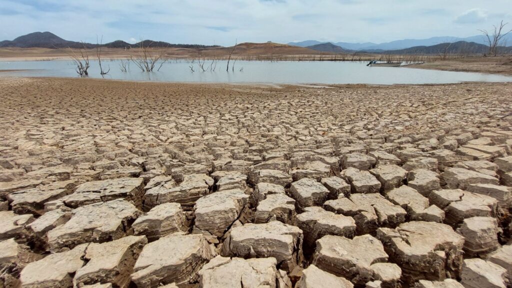
The drought is one of the effects of the climate change and in Mexico is a cyclical meteorological phenomenon that occurs every year, but has worsened.
According to the most recent Mexico Drought Monitorpresented by the National Water CommissionAs of August 31, 2023, the percentage of areas with moderate to extreme drought at the national level represented 60.98% of the national territory, 5.2% more than the August 5 report.
One thousand 479 of the country's 2,471 municipalities are considered in drought in this report and another 646 fall into the abnormally dry category.
It is in this context that researchers from the Mexican Institute of Water Technology have developed a model whose application through public policies aims to begin to mitigate the effects of the water risks most relevant.
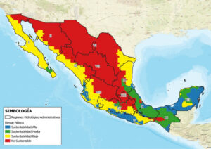
This tool is focused on assessing and mapping the water sustainability in the national territory for purposes of planning, development and operation of the water systems, highlights IMTA.
"In the face of the hydro-climatic changes the world is witnessing, we cannot afford to continue the degradation and depletion of increasingly significant water systems," he says.
The federal government agency indicates that in Mexico, the water availability has been a key component for the development of the country. In the long term, the benefits for its main users: population centers, industries, hydroelectric and thermoelectric power plants, as well as irrigated agriculture have been indisputable.
However, he stresses, economic growth and uncontrolled demographic expansion in a large part of the territory have led to the need to have water risksThese have manifested themselves through environmental and social impacts, especially on endemic ecosystems and native populations, which have been and continue to be negatively impacted.
"This tool is based on the integration of the intrinsic climatic conditions of a basin or aquifer and the change in its water storage and, from the beginning of 2002 to date, provides valuable information on the historical trend in water availability during the 21st century," explains IMTA.
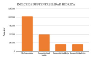
According to IMTA studies, currently more than half of the national territory has an unsustainable water security index, while a little more than 10% is not very sustainable, around 25% is moderately sustainable and around 10% is highly sustainable.


"Approximately 80% of the territory has had a decline in availability over the past 20 years, while the remaining 20% has had stable or increasing availability," he notes.
IMTA clarifies that the consequences on human activities as a result of a long-term decline in water storage in Chiapas will be very different from those faced in a basin or aquifer located in the Sonoran or Chihuahuan desert.
The mapping is intended to provide a quantitative diagnosis and identify those regions where public investment should be reallocated and incentives should be implemented by governments to reduce water demand effectively through a series of technological adoptions in the agricultural, industrial and public-urban sectors, to decouple economic growth from consumptive use at the regional level.
IMTA states that these indicators can be used not only within the public administration, but also by large water users, mainly in the central and northern part of the country, where the agricultural, livestock and industrial sectors account for more than 90% of water demand, and, therefore, where there are the greatest opportunities to move towards a more efficient use of water resources. more sustainable consumption.
Source: IMTA


